

I have just returned from about a 10 day journey all around the south western part of British Columbia (BC). In the start, I couldn’t decide before I started the journey where I wanted to go. I had four ideas, 1. South to the coast of Washington to surf, 2. Victoria to see my aging aunt and uncle, 3. north to see the family, 4. Up the sunshine coast to take photos. So, I decided to pack it all into one trip, except the Washington surfing, I fit it all in and then some! It seemed so right I don’t know why I hadn’t thought of it earlier..


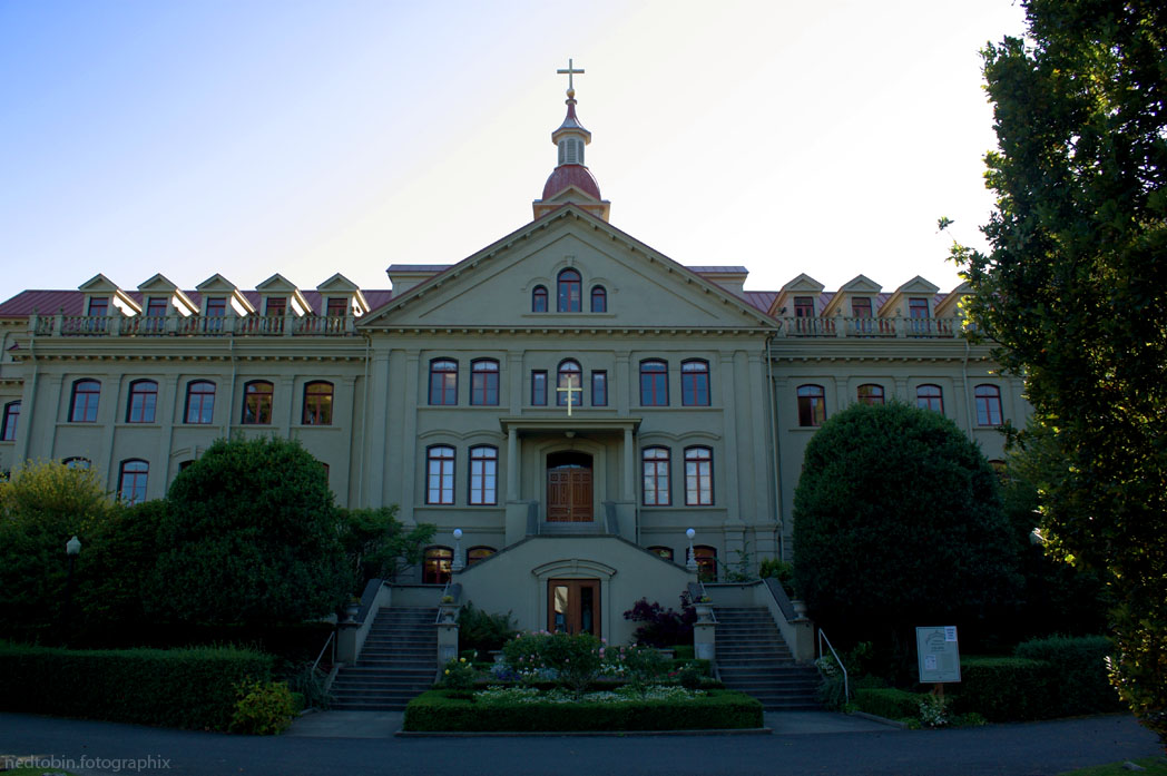
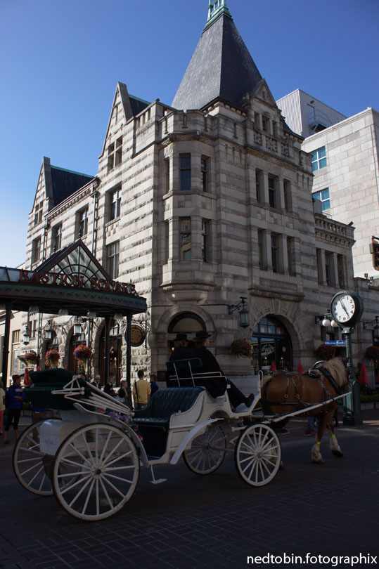
I started out at the Tsawwassen ferry terminal, in one of the most south western points of Canada mainland you can get. I took the 10 o’clock ferry over to Swartz Bay ferry terminal, which is about an hour north of Victoria, BC; I spent my first day hanging around Victoria, taking photos of the beautiful city.
My first night I spent at the Goldstream Provincial Park campground, which was bloody cold. I had a big mixup with my sleeping bag, so I was left with a few sheets and a small throw to use as my blankets for the night, which was too cold. The next day I learnt my lesson and bought another blanket.
The next day, I hooked up with a buddy at the Oak Bay Marina, where I went out for the day fishing for salmon on his boat. We caught 2 keepers which was great. I got to haul in one at the very end of the day, but it was to small to keep. Looked bloody big to me! Oh well. The chase is most of the fun anyways, I really wouldn’t have had anywhere to keep it. As it turned out, my buddy gave me a half fillet of the ones we caught, and I gave it to my great aunt and uncle who I met up with right after that. Always great to see them, I felt a bit bad though, for I had to call to tell them I was going to be late. I hope the salmon made up for it!

After hanging with the relatives for an hour or so, I booked’er out of the city and up to Rathtrevor Beach Provincial Park, where I got the closest spot next to the beach. I was a little worried because I rolled into there at about 2200hrs, and its a very popular campground, usually packed full, but I got a spot! It was pretty magical for it was a full moon, so I took my guitar and walked to the beach where I played for a few hours looking at the full moon lighting up the ocean and surrounding islands.

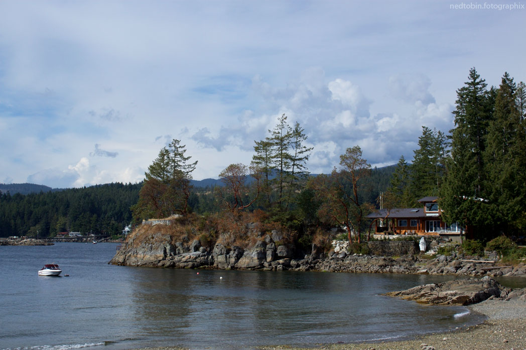
The next day I took the ferry from Comox to Powell River which was about an hour long. I got off, and headed north to Lund. It was another magical night, for I got to the end of the highway (Lund) and it was about 1700hrs, so I sat on the ‘Restaurant on the Dock’ where I sipped a few cold ones watching the sun go down and do amazing things on the marina.


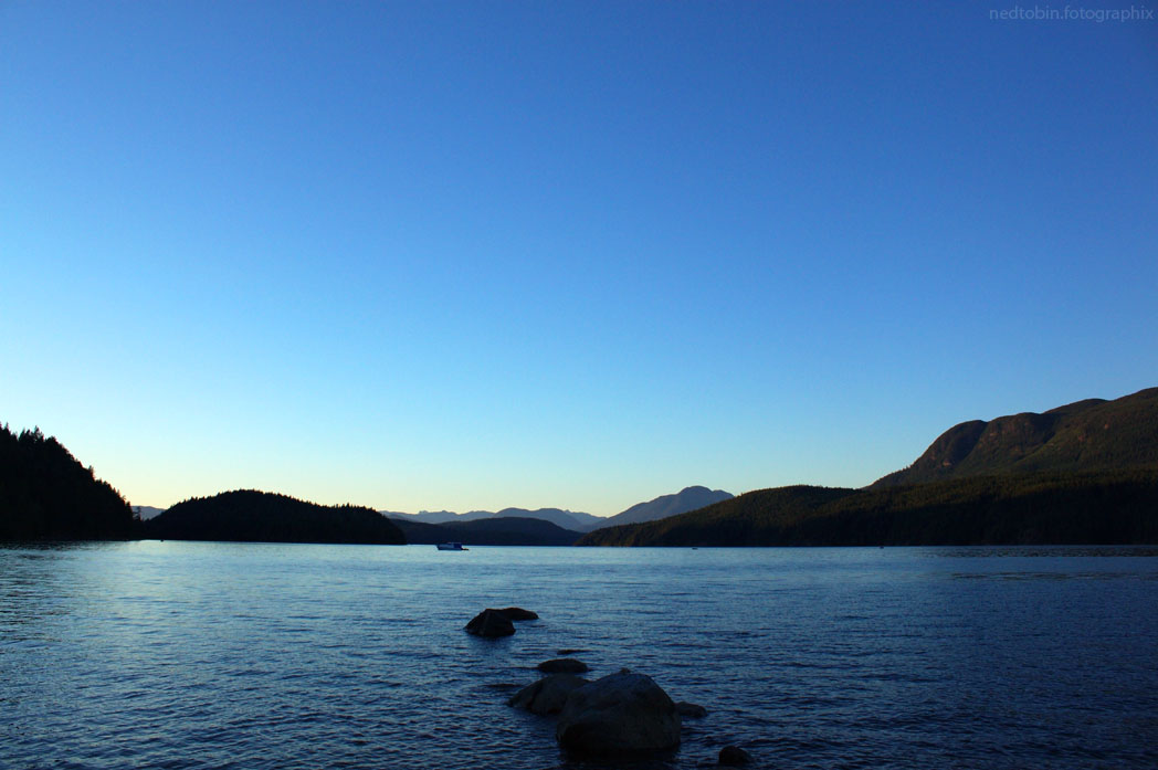
From here, I rolled across to Desolation Sound where I camped in the Okeover Arm Provincial Park, which continued the magic. I saw a whale flap its tail in the inlet, as well I could hear seals or otters talking all night long. I watched as the sun set from the bench right next to where my tent was. I think I took the spot that was reserved for day use, for it was the only place with a bench, not a picnic table, and no fire pit. Oh well, it was the best spot in the campsite if you ask me. I got there late and didn’t have to pay for the nights stay!
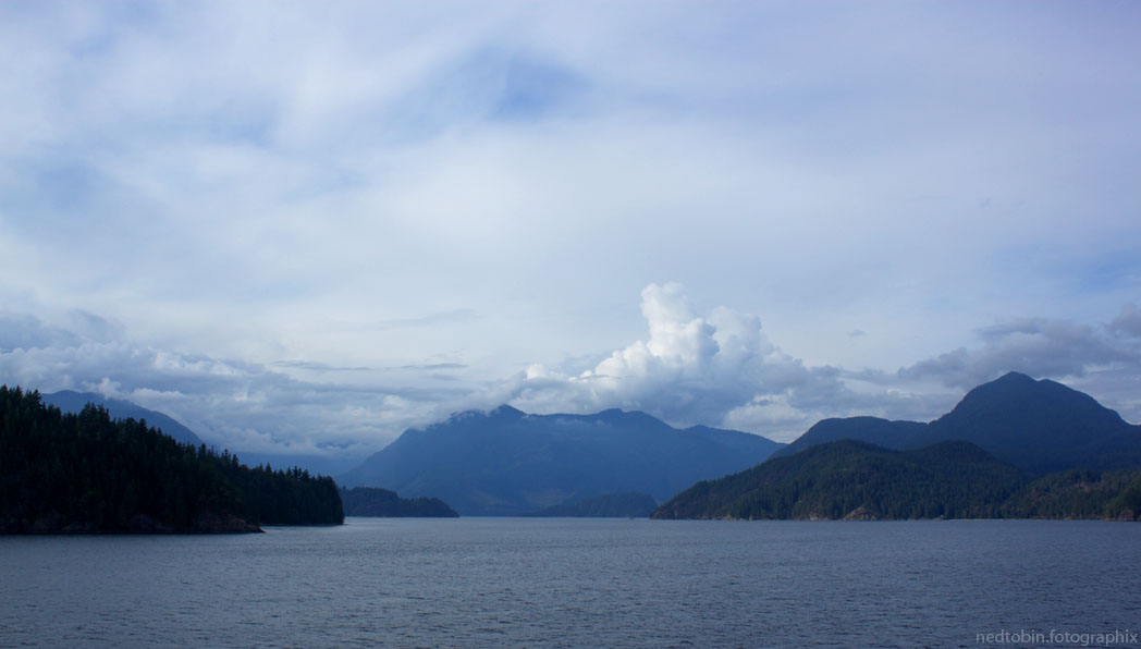
The next morning, I woke fairly early to break camp before the campsite supervisor came to charge me, and enjoyed a nice cup of tea watching the inlet glitter with the morning sun. From here, I drove south, through Powell River again, and on to Saltery Bay ferry, which took me across to Earls Cove. I decided to avoid all the ferry traffic so I veered north to Egmont, a little village on the north tip of the island (technically not really an island). It was cool, and I hiked into a weird little lookout at Waugh Lake.

From here I headed south along the Sunshine Coast, past all the little communities and artsy feeling stores. It was amazingly beautiful, we are so lucky here in BC to have these things right in our backyard, but in all honesty there are other parts of BC that I enjoy more. But, I had to document this part of BC so, I endured… er… smiled 🙂 .
I caught the ferry at Langdale, which is basically Gibsons. I was a bit worried I wouldn’t get on the ferry, cause I was waaaay up the road, waiting to get in through the gate into the waiting pen, which eventually started moving and I got on easily! This was the only ferry of the trip that I wasn’t into just sleeping in the back seat of the car, so I got to the top deck and sat in the sun reading my book the whole trip. It was beautiful going, although I’m used to it, its still an impressive piece of BC landscape. The ferry landed on home soil, in Horseshoe Bay, but I decided I wouldn’t go home, but head straight up north through Whistler and Pemberton, which is as far as I got before the sun was heading down and I had to setup camp.
I found a landing to camp just at the Lillooet Lake, which was kind of sketchy because it was traditional fishing grounds with a sign saying: “No Trespassing. Band members and relatives only.” I was scared about 1. a bear comign to play with me, and 2. a angry band member coming to get rough with me.. Needless to say, I broke camp at the break of dawn, but I waited to leave to explore down into the traditional fishing grounds. Maybe a stupid move on my part, but I walked down and didn’t really see much except a bunch of what looked like a giant mess. It was right at the foot of a creek that came into the lake, so I walked up that creek to my car, where I dunked my head under the fresh ice cold water to wake up! I found a loon feather too.
From here I drove continually north, it was amazingly beautiful, surreal as I drove through the alpine next to glaciers and watching the sun touch the peaks of the mountains. Stopping basically every km at amazing lookouts to take photographs.


I decided to try and head a bit south after Lillooet, see if I could take backroads up to Prince George, but I got to Gold Bridge, and went into the visitor information there and the lady kind of laughed at me and said no honey, you have to go back to Lillooet.

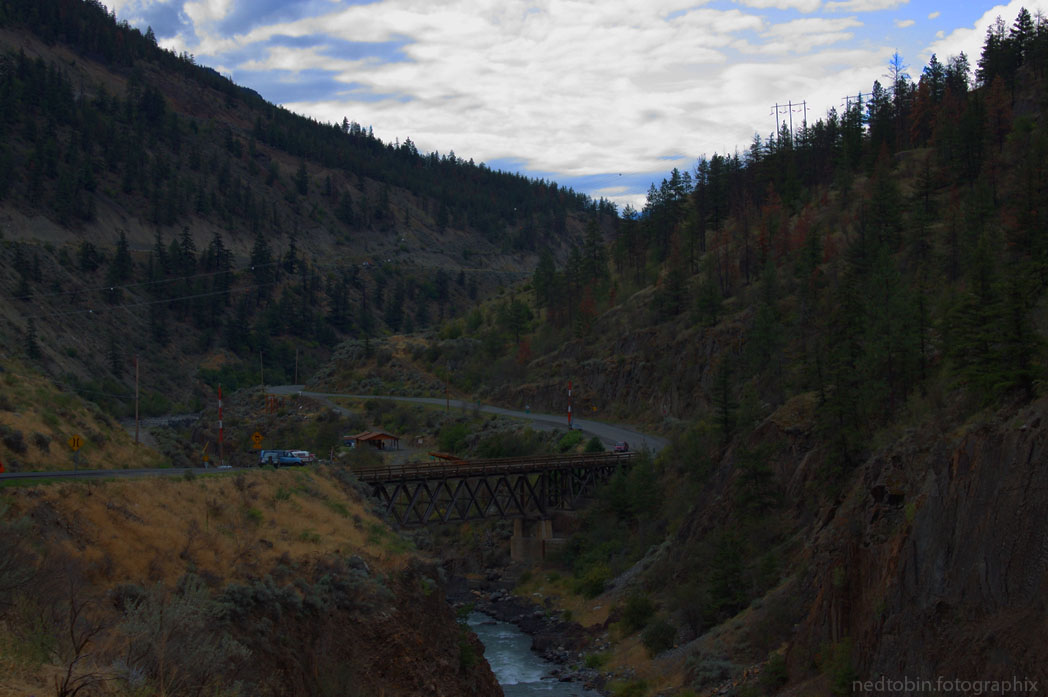
The good news about this was that it wouldn’t take me nearly as long, because on the way back I didn’t take nearly as many photographs as coming up, so a 2hr drive was only 1hr. So, 3hrs later, I was back to Lillooet, and headed north to Cache Creek along the mighty Fraser River. In all the that day, the multiple canyons I went in, Fraser Canyon is by far the most impressive. The rock formations and scenic awe inspiring beauty is unparalleled by any of the others. But, by this time I was starting to get tired, and the end of the drive was a warm bed and home cooking, so I didn’t stop as much as I would have liked to to take photos. To justify this, I had originally planned on doing what I already had done, and take photographs. I wanted to do the sunshine coast, and Lillooet: check and check.

So, I cruised onward and upward to Prince George, stopping whenever I could to snap a few national geographic worth shots, and enjoy the scenery. This concluded my journey, for the most part. Left was a day worth of driving down from Prince George to Vancouver, but this trip I wouldn’t be stopping for many photos for time and tiredness. I will make this another journey in itself.

How do you like the scenery? Have any of you done this trip? Whats your favorite part?